Liberty Ridge. The classic Grade III/IV snow-and-ice route on the insidious North Face of Mt. Rainier has earned innumerable superlatives; many consider it among the best climbs in the Pacific Northwest. An equal number of others, of course, dismiss it as overrated.
Featured in Roper and Steck's prestigious Fifty Classic Climbs of North America, the ridge splits the rarely climbed Willis and Liberty Walls, providing a relatively safe line to the summit at the cost of an arduous approach across the Winthrop and Carbon Glaciers, sustained steep snow, at least one pitch of alpine ice (often more, as our team would discover) and an alternate descent route requiring climbers to carry heavy packs up and over the 14,411-foot summit.
 |
| North Face, Mt. Rainier |
Immediately after summiting Rainier via the standard Disappointment Cleaver route in July 2012, I e-mailed my regular climbing partners about a big trip in 2013. The responses varied. As usual, however, Rob Jansen and I were on the same page. We knew it would take a year’s worth of dedicated training to make ourselves worthy of the challenge, but Liberty Ridge became the object of our obsession.
Sadly, Rob passed away in late August 2012 in a rock slide on Hagerman Peak before the trip progressed beyond the planning stages. At the time of his death, we'd climbed more than 25 mountains together in a mere 10 months. The loss of my close friend and No. 1 climbing partner shook me to my core. His father told me during the memorial service to keep "carrying the torch" for his son, and I knew that meant going forward with our mutual dream of ascending Rainier via our dream route.
James Graham and Darrin Nicholas were my mentors as I transitioned from East Coast beach bum to 14er finisher, and I count both among my closest buddies. It was a special moment for me when they invited me to join their own Liberty Ridge attempt a few months later. I readily agreed.
The reality, however, was that James is a good deal heavier than us, and the crevasse danger on the Carbon glacier is real. Darrin and I might have had problems if James took a fall. For that reason we added a second rope team to the party, consisting of three other climbers: Nao Takano, Keegan Young and John Fatseas.
I applied for and was awarded a Live Your Dream grant from the American Alpine Club for the climb, and without such support this trip wouldn’t have been possible. A huge thank you to everyone at the AAC for allowing me to live not only my dream, but one which Rob and I shared. I'm also indebted to Eddie Bauer/First Ascent Park Meadows, which let us demo a First Ascent Katabatic when we needed a second three-man mountaineering tent.
Climbing expeditions rarely go as planned. The trip I'd imagined as we boarded our plane on the morning of Saturday, June 8 was vastly different than the trip I’d experienced by the time I was on the return flight Sunday, June 16. I can say without a doubt, however, that the vacation was a success for our entire six-man team, and everyone made the correct decisions for themselves. We came home alive, we came home friends and we came home with summits.
MT. RAINIER - LIBERTY RIDGE
Weather windows in the Pacific Northwest are rare, especially in June, and we were graced with a beautiful one. Sunday and Monday were mostly sunny with no chance of precipitation during our approach, and Tuesday, our summit day, called for partly sunny skies with a small chance of precipitation toward the evening. A minor storm was forecast for Wednesday and Thursday.
The ranger at White River told us to bring snowshoes, which caused a communal groan heard as far away as Paradise. Previous parties reported chest-deep snow followed by bare ice from 12,500’ to 14,000’. The ice beta proved accurate, but the snowshoes stayed on our packs for 98 percent of the trip.
 |
| Setting off |
The meandering trail from the White River Campground switchbacks ever upward, crossing streams and offering fleeting views of Rainier’s upper reaches. We started encountering snow around 6,000’ and finally popped out above treeline onto the Inter Glacier after 2.5 hours of hiking.
Some donned crampons here, while I opted for snowshoes because I figured the heel lifts couldn’t hurt for the slog up to St. Elmo’s Pass. We entered our own little worlds and formed a strung-out line on the crevasse-free Inter Glacier, ascending at various paces. Gaining St. Elmo’s Pass meant traversing onto the Winthrop Glacier and the removal of ~10 pounds each worth of ropes and hardware from our packs. Motivation came easy.
Roped to Keegan and Darrin and followed by Nao, John and James, we set off across the glacier. The Winthrop is hideous up high, but our line stayed flat and angled slightly down toward Curtis Ridge. We crossed our fair share of crevasses, maybe a dozen, but all were less than a foot wide that early in the season.
 |
| Crossing the Winthrop Glacier |
The lower slopes of Curtis Ridge are wide and deceiving. To make matters worse, a cloud-and-fog layer rolled in and obscured our views. Time and time again, we thought we’d reached camp, only to see more ridge awaiting ahead. The best advice I can give to prospective parties is when in doubt, angle down (right). The best campsites are around 7,200’ to 7,400’. The Carbon Glacier is easily accessed by a 50-foot scree slope lower on Curtis Ridge, but you’ll become cliffed-out by ascending too high.
We pitched our two three-man tents in the only flat spots we could find. The fog occasionally gave way to teasing glances of Liberty Ridge above. Every time we climbed a nearby cliff to scout a safe path across the Carbon, clouds reappeared. The routefinding would have to wait for morning. Our bellies full and snow melted, we crashed as soon as we could, with alarms set for 4:30 a.m.
 |
| Curtis Ridge Camp, with Liberty Ridge partly shrouded behind |
Cue the best sunrise I’ve seen in my life. It took a full 20 minutes longer than usual to get ready because I couldn’t pick my jaw up off the talus. Finally ready to move an hour and a half later, we were ecstatic to find the short scree slope onto the Carbon Glacier within a stone’s throw of our campsite. The early morning light on Liberty Ridge revealed our beta was accurate: everything above the Black Pyramid was a shimmering field of ice.
 |
| Liberty Ridge |
Some consider the Carbon Glacier the most dangerous section of the entire route. It’s Rainier’s thickest, longest and most active glacier, with a reported depth of 750 to 900 feet. Massive crevasses yawned everywhere. The morning quiet was interrupted at regular intervals by the gunshots of collapsing seracs. A 30-second waterfall of rocks fell from the toe of Liberty Ridge itself, and hundred-foot-wide avalanches swept silently down the Liberty and Willis Walls, threatening anyone who got too close. It was time to focus.
Despite the surrounding dangers, we raced across the Carbon. The flat, middle part of the glacier was remarkably lacking in open crevasses. Above the 7,600’ level or so, the routefinding became more tricky. We routinely had to step over foot-wide crevasses, including one on an uphill slope that required the solid placement of an ice axe pick for most of us, and another that was actually two crevasses with a thin intervening platform. We also trod through a small icefall, weaving around seracs and over a wonderland of snow formations. It was dangerous, sure, but my God was it beautiful. Even now I smile in reflection.
 |
| Onto the Carbon Glacier |
Above the icefall, the glacier once again flattened out and we stopped for a break. The entrance to Liberty Ridge was less than an hour away. Another serac collapsed on the Liberty Wall, starting a minutes-long avalanche that appeared close enough to touch. We started again, but stopped a few hundred feet later to have a group meeting that would change the course of my week.
 |
| Break time on the Carbon |
For several valid reasons, James expressed that he was throwing in the towel. The rest of the group wanted to press on, including myself. Backtracking over the wicked Carbon and the milder but still broken Winthrop was inarguably roped-up terrain. James walking out alone, especially with the day heating up, would be taking an enormous risk.
I wanted the route more intensely than any I've attempted in my life and I couldn't have felt stronger. I'd trained hard, given up drinking for months, learned a ton of new skills, read and re-read trip reports and route beta, sought grant opportunities with the AAC -- it's not an exaggeration to say Liberty Ridge dominated nearly a full year of my life.
I searched inward. This climb, for me, was as much about remembering my friend Rob as achieving personal success. Every step was one I should have been taking with him. I began to wonder what Rob would do in that situation. He was one of the most selfless climbers I ever met, and there on the glacier I recalled a memory I shared during his memorial service. Long story short, he once told me, “You’re my friend, and I’d do anything for you.” James is one of the better friends I have. I understand how cheesy it sounds, but my choice was suddenly made for me. With only a touch of reluctance, I opened my mouth and told James I'd head down with him.
Before another half-hour passed we had the ropes reordered, the gear redistributed, and the respective teams of four and two were ready to go their separate ways. Darrin was already ahead, but as John, Keegan and Nao trudged by, I shared a moment and a hug with each of them. I wished them sincere good luck and lent John my camera. Then, it was time to go down.
MT. HOOD
 |
| Mt. Hood, South Side |
The plan was to take a rest day or two while waiting for John, Darrin, Keegan and Nao to come off Rainier and join us for an attempt on Mt. Hood. Unfortunately, the other members of our party ended up having such an epic on Liberty Ridge that they decided against any more climbing and caught early flights home. James and I headed down to Hood on our own. We were joined by good friend Bill Wood, who found a cheap last-minute flight from Denver to Portland.
While Mt. Hood’s standard Hogsback route pales in difficulty compared with Liberty Ridge, the highest point in Oregon is no slouch. Hood, simply put, is aesthetic. It’s often said that if you ask a kindergartner to draw a mountain, the picture you’d get in return is Mt. Hood. The slopes sweep upward from all directions to reach a perfect pinnacle, eternally capped with snow. From certain angles the mountain calls to mind Wham Ridge blanketed in white.
After waiting out a few days of imperfect weather, Friday promised to be better. It didn't seem that way when our alarms went off at 3 a.m. Outside the Best Western, the world was shrouded in mist. A startlingly chill wind whipped us from all directions. Regardless, we were there, we were awake and this was our one shot. We piled into the rental car and drove up to the trailhead at Timberline Lodge.
I was on a mission. Most parties hit the trail closer to midnight, but we cocky Coloradans were lazy and aimed for a 4 a.m. start, which in actuality became 4:30. I was concerned about being forced to turn around by late-morning falling rocks or ice, or the cloudlayer rising with the day’s heat. As has been proven in tragedy after tragedy, the upper slopes of Mt. Hood are no place to be caught in a whiteout. Though we carried ropes and a small rack as a precaution, the likelihood of needing them was nil. I bolted for the summit as fast as I could manage, with the mutual understanding I’d stop to wait for James and Bill if conditions warranted.
 |
| Sunrise over a cloud layer on Mt. Hood |
My personal goal was to top out by 9 a.m. Maybe it was my Colorado acclimatization, maybe it was my fear of leaving the Pacific Northwest without a summit, or maybe I was simply channeling my inner Rob Jansen (he was an exceptionally fast hiker and finished 33rd in the 2012 Leadville Marathon), but I was shocked to find myself on the summit at 8:30 a.m., four hours after setting out.
The first 2,500’ of the route is as boring as snow climbing gets. One literally walks up a ski slope, using a chairlift as a guide. The views we had that morning made even that portion enjoyable. The entrapping cloudlayer leveled off at about 6,000 feet, the same elevation as the trailhead. We were soon above it. Sunrise hit early because of our late start, and it presented an astounding scene coupled with the low clouds, nearby Mt. Jefferson and Hood’s own mountain shadow.
 |
| Hogsback and Mt. Jefferson |
I caught a large group of several parties at the Hogsback, where everyone stopped to put on crampons. Here, only 700 feet from the summit, the route becomes spectacular. Fumaroles spewed wisps of steam that polluted the air with sulphur, singeing the nostrils; a single crevasse known simply as the bergschrund gaped wide; the Hogsback provided an aesthetic line of ascent and the final push beckoned as a fine snow-and-ice climb.
In years past, the Pearly Gates -- a direct line from the top of the Hogsback to the summit -- was the standard route. Recent shifts in weather have made this section steeper and icier, so most climbers traverse left to a snowfield known as the Old Chute. Now ahead of the masses, I took the middle ground, up a narrow tunnel of hard 45-degree snow called the Two o’ Clock Couloir, embraced on all sides by towering rocks armored in rime ice. The other parties, including a family of skiers from Aspen, followed up the same route.
 |
| Two o' Clock Couloir |
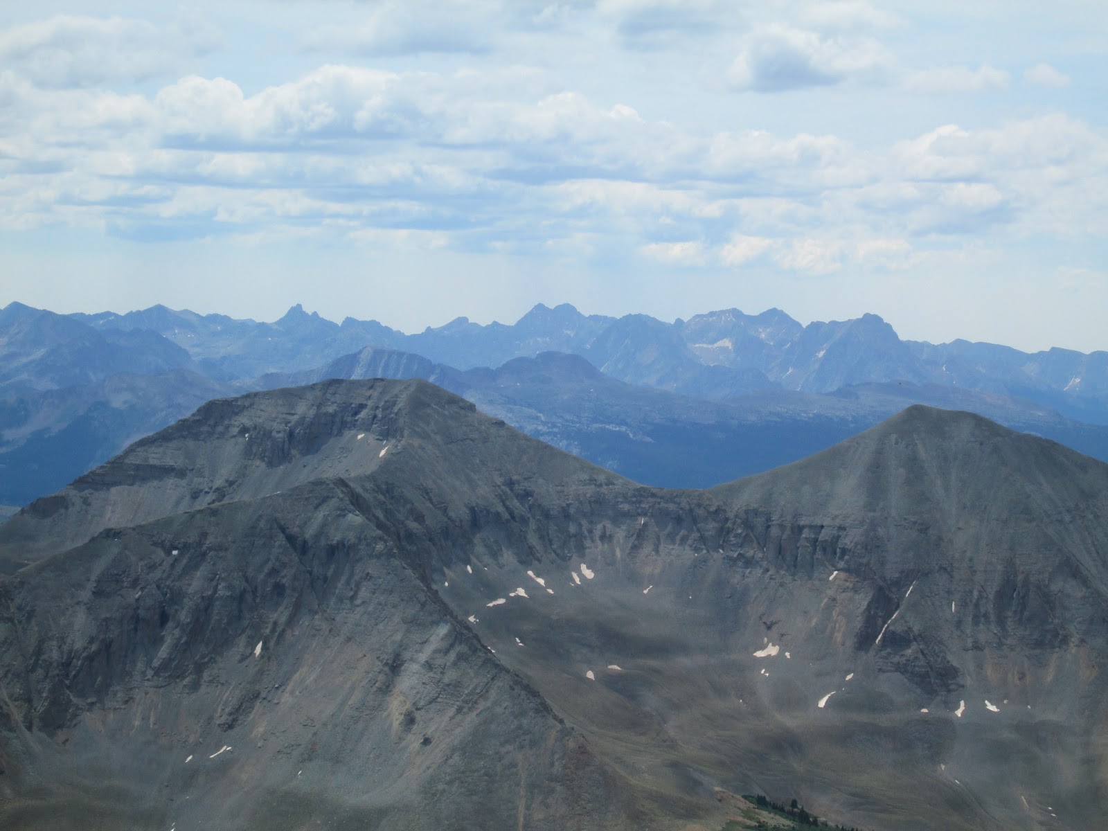
The top of the couloir revealed the summit ridge and views unlike any in Colorado. It was the Blanca Group on steroids. Mt. Hood, an ultraprominent peak, offers incomparable scenery in every direction. Mt. Rainier and Mt. Adams rose proudly to the north, while Mt. Jefferson and the Three Sisters were only slightly less impressive to the south. The neutered mound of Mt. Saint Helens was a harsh reminder of the fate awaiting these active volcanoes.
 |
| Summit ridge |
After turning around on Liberty Ridge, my chest swelled with the elation of success. I put on my puffy and was soon joined by the other groups, including the Aspenites, who skied from the summit. Bill and James arrived a short while later. Standing at the apex of a mountain like Hood is an awesome personal accomplishment, but it wouldn’t mean nearly as much without friends such as these to share the victory. I spent a few minutes gazing longingly at Rainier, though I didn't dwell; I was happy where I stood.
We lingered on the summit until about 10 a.m., then started down. A combination of glissades and a good climber’s trail saw as back at the lodge before noon, with beers from Mt. Hood Brewing Company in our hands by 12:30. A toast to success!
 |
| Mt. Hood summit |
CONCLUSION
As I've said, the trip turned out very differently than I’d drawn it up. That doesn’t mean I’d change anything. With a team as strong as the one I had and as hard as I'd trained, I have full confidence I would have made it up Liberty Ridge. But as the cliche goes, the route will always be there. I gained more personal pride in helping a friend in need than I ever would have simply succeeding on a route. People climb mountains for many reasons, and I've discovered that I do it mainly for the camaraderie.
More philosophically, before the trip the prospect of succeeding on Liberty Ridge was almost a sad one. It was the last of many adventures I’d planned with Rob. Once it’s done, I have a feeling I’ll be a bit rudderless for a while. As long as Liberty Ridge remains a dream, something on the horizon and not yet behind, maybe I’ll continue to feel this strong connection to my friend. I’m sure I’ll be back one day. That trip will come when it will. Until then, I’ll continue living other dreams, remembering my lost compatriots in other ways and enjoying the friend that remain to me.
Thanks again to the AAC for allowing this journey to happen. I'm truly living my dream.