Showing posts with label Trip Reports. Show all posts

Tuesday, April 7, 2015

A Bond Between Strangers (Boudoir Couloir)

There's no point in denying it: Horseshoe Mountain's Boudoir Couloir is a flat-out classic. I'd already climbed it in 2011 as one of my first snow climbs, but when Speth suggested it for this weekend, I had no qualms about returning. This April is all about getting into shape for the Skillet Glacier, anyway. If a route has snow and vertical gain, I probably won't say no.


Boudoir Couloir is the obvious snow line left of center.

We were forced to park about a mile short of the standard starting point at Leavick due to lingering snow. A few poor souls had tried to drive a bit farther. Carnage ensued. Three-foot-deep tire tracks, busted wooden boards, a wrecked tow strap and, of course, their abandoned vehicles. All that to avoid walking an extra five minutes. Human nature is a funny thing.

Speth and I were walking by about 7:30 a.m. My memory had blocked out the difficulties of the approach, and for some reason I thought it would only take us about an hour to reach the base of the couloir. In reality, including the extra slog to Leavick, it took us three. A little less than a mile from Leavick is a road that branches off left and crosses Fourmile Creek. Follow it as it switchbacks up a couple hundred feet to break treeline, then make a straight shot for Horseshoe's namesake amphitheater. Many options exist to reach the base of the couloir. Gerry Roach's guidebook suggests angling to hiker's right around two small lakes. As the lakes remained solidly frozen, we took a more direct line straight across.


On the final approach. (Photo by Matt Speth.)

We reached the base of the couloir around 10:30 a.m. I'd normally be nervous about starting an east-facing spring snow climb so late, but the temperatures were mild and a stiff breeze kept everything firm. Speth hadn't even used snowshoes for the approach. While gearing up with crampons, helmets and ice axes, we were joined by fellow 14ers.com members BKS (Brian) and eskermo. Brian also had his 2-year-old labradoodle, Charley.

Being an English nerd, I was absolutely tickled by the company of a poodle named Charley. Surely his owner must be a Steinbeck fan? Actually, no -- it was a total coincidence. Charley was a joyful companion, and I used the encounter for the title of this blog entry. If you don't know what I'm talking about, famous novelist John Steinbeck (Of Mice and Men, The Grapes of Wrath, East of Eden, etc.) wrote a travelogue in the 1960s about a year-long road trip across America with his full-size poodle, Charley. Travels with Charley is one of my favorite travel books. Contained within is the quote, "Dogs are a bond between strangers." How true is that?

We started switchbacking up the apron on perfect snow. Our boots were sinking in to about lace-level and the crampons bit hard. It was much more relaxing than the first time I'd climbed Boudoir on bulletproof névé.

An intermittent old boot-pack existed in the middle of the couloir. I tried to use it at times, but given the moderate angle and great snow conditions, switchbacking was much more efficient.


About halfway up.

Me, nearing the constriction. (Photo by Matt Speth.)

A truly unique amphitheater.

Speth gives a thumbs up near the top. (Photo by Matt Speth.)

Charley, Speth and Brian approach the summit plateau.

In addition to being an aesthetic line, what makes Boudoir special is the spectacular setting. Horseshoe Mountain's entire east face is a half-moon of near-vertical cliffs. Boudoir offers the only easy passage. Rest breaks were passed giddily spying other potential snow, ice and mixed lines in the breathtaking amphitheater.

What else makes Boudoir a must-do? The direct finish over a mini-cornice onto the summit plateau. Immediately above the exit is a remarkably intact old mining cabin, which we crawled inside to escape the increasing wind. Views of the Sawatch, Sangre de Cristo, Tenmile and Mosquito ranges did not disappoint. We ditched our packs and most of our gear inside the cabin before strolling over to tag the true summit.


Mining cabin on the summit.

Every mountain should have a wind cabin.

Travels with Charley.

Group on the true summit.

Normally I would have suggested walking off the standard Northeast Slopes route, but the Skillet Glacier will require downclimbing snow up to and including 50 degrees. I figured I might as well practice walking down moderate/steep snow as much as possible. It was still a bit firm for easy plunge-stepping. Once we were through the constriction and the angle began to relent, we popped off our crampons and glissaded the rest of the way in a matter of minutes.


Walking down. (Photo by Matt Speth.)

One last look at Boudoir. Until next time!

We followed our tracks out and reached the car only two hours after leaving the summit. Glissading is awesome. The wind had even kept the snow remarkably firm for an April afternoon. No waist-deep postholing in snowshoes necessary. A perfect spring day. We did have a bit of difficulty finding a dining option in Fairplay given the Easter holiday and my low-carb kick this month, but we eventually settled in at McCall's Park Bar. Let's just say a 1/4-pound buffalo burger with no bun and a side salad is no match for a post-hike appetite. It's going to be a long month...

Thanks for reading.


Tuesday, March 17, 2015

Dawn Sessions: Coors Lite Before Work

The idea bloomed as soon as I saw the 10-day forecast. Highs in the 60s and 70s would likely spell the end of waterfall ice-climbing season, and I wanted a few final sticks.

Speth, John and I had “discovered” the ice in Clear Creek Canyon the prior weekend while driving home from a horrific experience on wilting Silverplume Falls. After traveling 1.5-2 hours to different climbing destinations all winter, I felt a little silly at never having explored the roadside ice a mere four miles from downtown Golden. Worried that the heat wave would melt everything before my next day off, I pinged the usual suspects to see if there was anyone else desperate enough to try pre-work ice climbing.

Initially, there wasn’t.

(I work in Golden and most of my partners work in Denver, so it was admittedly an easier proposition for me.)

Keegan, as usual, came to the rescue. He was freshly returned from a month abroad, and I knew he’d be jonesing to get on any remaining ice. I drove up Clear Creek Canyon on my lunch break, snapped a few pictures and forwarded them along. It was an instant sell. A few minutes later he responded inquiring about the start time and what gear he should bring.

We met at 6:30 a.m. It took longer than anticipated to put on our gear and walk to the base of the climb, called Coors Lite. It was a few minutes after 7 a.m. by the time Keegan started up, with a painted sunrise illuminating the gunsight-like view down canyon.

Sunrise toward Golden from the belay.

The first pitch of Coors Lite comprises three near-vertical steps, the first of which is the tallest at about 20 feet. The second and third only require a couple moves. We caught the ice in surprisingly decent condition, especially on the first step. Keegan topped out after placing only three screws, built a belay and brought me up. 

Keegan at the anchor, belaying from above.

On the third step. (Photo by Keegan.)

We were hoping to check out the second pitch, or at least complete another lap on the first. Unfortunately, we’d already run out of time. I had to be at work at 8 a.m., which is about the time we got back to the cars. Oops. I straggled in 15 minutes late, stayed a bit later than normal and began plotting an earlier return the following morning.

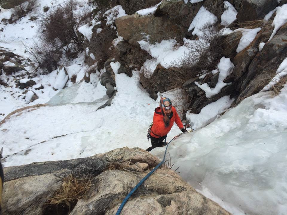
Sam was my partner for Friday. We met at 6:15 a.m. and got going as quickly as possible. It was my turn to take the sharp end, only the second time I’ve led ice. The first was a few weeks ago on a short WI3 bulge at Zapata Falls. Though separated into three tiers, Coors Lite is a significantly longer pitch. There was also much more running water than the previous day. I was admittedly nervous, but tried to rack my harness and start taking swings before my mind fully awoke.

Second lead. (Photo by Sam.)

The fear was soon replaced by the joy of climbing. I sunk two decent screws into the initial step and another more dubious one at the base of the second. The middle step ended up being the crux. There was more running water than ice, and even the solid placements I could find were thin. Luckily, there were good bucket-steps for my feet and I was able to move up using careful balance and equally weighted tools.

I placed a fourth screw in the first thick-looking slab I could find on the flat ground between the second and third steps. The third vertical section was also thin and wet, but came with better protection. I put a fifth screw in a thick bulge and finished to the two-chain anchor.

Of course, I hadn’t climbed nearly as fast as Keegan. By the time Sam joined me at the anchor, it became apparent we’d both need to skedaddle in order to make it to work on time. I didn’t want to be late two days in a row. Sam trotted down the walk-off to sort gear at the base while I rigged a quick rappel; my line was going to stay in place for a few other friends, who had started the morning at nearby Mickey’s Big Mouth, to come top-rope.

Sam on top of the first step.

Rappeling to the base. (Photo by Sam.)

It was a whirlwind effort, but I sat down at my desk just as the clock ticked over to 8 a.m. Speth, Mike, Ben, Andrew and John kept on climbing for a few hours at Coors Lite and Mickey's. Lucky bastards. Extra special props to Andrew, who was ice climbing for his very first time.

Waking up a couple hours early for two days in a row was a pain, but I’m damn glad we went. I doubt the ice was still there Saturday, and with 80-degree highs both Sunday and Monday, it’s definitely gone now. Time to figure out how to not suck at rock climbing and get in shape for summer hiking. Oh, and then there’s that glorious spring snow...


Wednesday, February 18, 2015

Third Time's the Charm on Mt. Princeton

MOUNTAIN: Mt. Princeton (14,197')
ROUTE: East Slopes
RT GAIN: 5,400'
RT DISTANCE: 13.25 miles
RT TIME: 10.75 hours
PARTNERS: Jerry, Adam, Shawn, Joel

Mt. Princeton had become something of a winter nemesis. I tried it in early January 2014 prior to shoulder surgery, but the recurring dislocations that necessitated said repair left me woefully out of shape. I only made it as far as subsummit "Tigger Peak," a mile or two and nearly 1,000' short of the summit. Princeton was also the plan three weeks ago, but I was forced to bail last-minute for a variety of reasons.

Third time's the charm, right? I roped a few poor souls -- Shawn, Joel, Adam and Jerry -- into yet another winter attempt Sunday, Feb. 15. Most of the Colorado high country still looked more like early fall than mid-February, and with the weather pattern changing toward more frequent snow beginning this week, I figured I better poach an easy winter summit while the option remained.


The group started from the lower trailhead at 6:45 a.m., faced with a few miles of road walking before reaching the standard summer starting point. Snowshoes weren't necessary and the distance melted away. As the day grew warmer and the sun burned off the early-morning clouds, some of us even found ourselves in baselayers. Of course, with a storm scheduled to roll in during the afternoon and high winds obvious up high, we knew it wouldn't last.

The rest of us caught up to Jerry, who'd dashed ahead at superhuman speed, at the only real decision point we'd face all day. The road continues to above 12,000', but the summer route leaves it on a good trail that traverses across the face of "Tigger Peak" to the low point in the saddle between "Tigger" and Princeton. Most winters, avalanche danger dictates forgoing the summer trail and going up and over "Tigger" instead, at the expense of some extra mileage and about 800' of added elevation gain. The minimal snow levels convinced us to take the easier option and stick to the trail.


The "easier option" was still kind of a pain. The Mt. Princeton trail consists of large, loose, annoying talus. Add a foot or two of powder on top of it and the going becomes very slow and tedious. Jerry continued leading the way as the weather began its preordained decline.

Princeton's summit looked tantalizingly close. Almost every winter trip report I read had a huge round-trip time that didn't align with the 13.25 mile/5,400' stats. Sometimes it even took people 20+ hours! Now, I understand why. Most of terrain above 12,000' is simply horrid. If we'd had to deal with trailbreaking in snowshoes and going over "Tigger," it likely would have taken us much longer as well. The path becomes more and more intermittent, replaced with steep scree, loose talus and ankle-breaking murder holes. The final push to the summit took about twice as long as I expected at first glance. We finally topped out, one after another, between 1-1:20 p.m.

The forecasted storm was arriving in earnest. I stayed on the summit only long enough to eat a sandwich and snap three pictures. No one else bothered. Clouds and light snow had already rolled in, with the wind whipping around at 30 or 40 miles per hour.


On such hideous terrain, the descent took almost as long as the climb. I think we all wanted to kneel and kiss the ground when we were finally back on the solid trail. As nice as that was, regaining the road was even better. We rested for a while at the junction to eat, drink and adjust layers, tasks we'd neglected for a few hours in the deteriorating elements.

Thus replenished, the stroll down the road was lighthearted and victorious. The storm produced a veritable whiteout at times, with an inch of snow falling per hour and visibility reduced to a couple hundred feet. Safely on the road, however, we had little to worry about. We spaced out a bit, with the last person returning to the vehicles around 5:30 p.m. It's not often you can do a long winter daytrip without needing a headlamp. Not to say we were especially quick -- just lucky with the conditions.


We tried to stop at Eddyline Brewing for a post-climb meal, but shockingly there was a 45-minute wait on a Sunday night in the middle of winter. We instead visited a Mexican joint down the street on Joel's excellent suggestion, which hit the spot just the same. Thanks to Joel, Adam, Jerry and Shawn for a fun day. Now, back to ice climbing...

Tuesday, October 21, 2014

Getting the Band Back Together

Marble Mountain (13,266')
ROUTE: East Ridge
RT DISTANCE: ~7 miles
RT GAIN: ~3,500'
RT TIME: ~7.5 hours
CLIMBER(S): Dan McCool, Ben Shulman, Jeff Golden

I’ve always held the belief that the people with whom you share the trail are the best part about hiking. Lifelong bonds are made in the hills. The common goals, the shared risks, the glorious successes and the crushing defeats -- mountaineering pulls us together in a truly profound way.

I’ve formed one of those lifelong bonds with Dan. Ben, too, but we used to live together so I've had my fill. Though our priorities have shifted and we’re no longer able to meet in the mountains nearly every weekend, when we get together it’s always as if nothing has changed. That goes for most of the folks I regularly hiked with in 2011-2012 while we all raced toward the 14er finish line. Unfortunately, as it often does, life has taken us in different directions.

When the idea materialized of a reunion hike on Marble Mountain, I knew it was something not to be missed. Prior commitments and injuries got in the way of it being fully attended, but still, getting out with Ben and Dan is about as perfect a day in the mountains as a man can reasonably expect. It’s guaranteed to be a memorable outing.

We arrived at the Rainbow Trail/South Colony Lakes Road junction late Friday night after a necessary pitstop at Phantom Canyon Brewery. Terrified of the swarms of ATV-riding Bubbas in camouflage, Dan and I opted to sleep in the back of his truck. Ben, the bravest of our trio, pitched his bivy sack off to the side of the road. Expecting an easy day, we decided on a gentlemanly start of 7:30 a.m.

The morning began with a short jaunt in the wrong (...but right…) direction on the Rainbow Trail. It’s an odd feeling walking away from the mountain you’re trying to summit. Luckily it’s less than ¼-mile before you take a right onto a climber’s trail and start hiking up Marble’s East Ridge.

The trail is strong in places, and impossible to follow in others. The line is pretty obvious, however; as long as you’re hiking upward and staying near the ridge crest, you can’t go wrong. Good thing, too, as a heinous amount of deadfall had us weaving every which way. We were sporting dozens of new nicks and cuts by the time we finally emerged from treeline. Oh well. Bushwhacking builds character.

Dan enjoying the morning bushwhack.

Snow was unavoidable for a couple hundred feet after treeline, about six inches over slick tundra and wet rocks. This was the most tedious part of the route. Higher on the ridge the wind had blown it mostly clear, and in many ways it was reminiscent of summer. Dry tundra, T-shirts, sweat and size 14 boys jorts.

The walk to the summit probably took an hour longer than it should have thanks to the copious amount of Crestones photos that needed to be taken. Marble is a benevolent lump of tundra, requiring only a very minor false summit before the ridge ends in the true highpoint. After drooling over the Crestones all morning, we were pleasantly surprised to see that the views in the other directions were just as breathtaking.

Ben models his size 14 jorts while sizing up the Crestones.

Ben and Dan working their way up the East Ridge.

It was cool to see Dan reach the top. He hadn’t been on a high-altitude summit hike in nearly a year, and he wore a child-like expression of wonder on his face. It was a great reminder not to take these adventures for granted. Going out most weekends, it’s easy to lose perspective on what drew us to the hills in the first place. Dan’s awe and joy after a lengthy time away were palpable.

We lounged on the summit for about an hour, drinking a couple beers and watching a storm roll in over Kit Carson and the Crestones. If possible, the clouds made the Sangres even more beautiful.

Crestone Needle and Crestone Peak.

Summit shot. (L-R me, Ben, Dan.)

We started down the deceptively long ridge just as the first flurries were starting to fly. We stayed well ahead of the full brunt of the storm. Regardless, it was simply a tundra stroll back to treeline and the trail. Many stops were again necessary for even more photos of the Crestones.

With a light mist falling back at the truck, we decided to delay our planned post-hike beers until back in Westcliffe. South Colony Road was much rougher than I remembered, but we made it safely down the 2.5 miles to the 2WD trailhead without incident. We got to-go pizzas from Tony’s (the Western is the best BBQ chicken pizza I’ve ever had) and popped open our beers at an undisclosed and probably illegal location with great views of the Sangres. Great ending to a much-needed jaunt with old friends!

Pizza, beer and a fine view.

Wednesday, October 8, 2014

A Winter Preview on Quandary's West Ridge

Saturday was one of those times everything just comes together.

As of early afternoon Friday, I still had no idea what I wanted to hike over the weekend. I would have loved to make the 14ers.com Fall Gathering in Lake City, but with a three-day trip to Vegas right around the corner, I wanted to spend a bit of time Sunday at home with Kate, Remy, yardwork and Carolina Panthers football.

What I did have was interest from two of my favorite climbing partners, Ryan Kushner and Matt Speth. We bounced ideas back-and-forth until it seemed unlikely we’d ever reach a consensus. I was starting to resign myself to a mellow solo hike when a mutually interesting goal finally emerged: the West Ridge of Quandary Peak.

Quandary Peak - West Ridge

Ryan also recruited a few of his other friends, local climbing celebrities Alan Arnette (fresh back from success on K2), Jim Davidson (author of The Ledge) and Chris Tomer (FOX31/Channel 2 meteorologist). They agreed to join after their original goal of the Bells Traverse fell through due to last week’s snowfall. It was my first time hiking with all three of them, though I’ve rubbed shoulders and shaken hands at various events over the years.

We opted for a gentlemanly start of 8:30 a.m. Saturday. The route generally takes 6-8 hours roundtrip, and with no more fear of monsoonal thunderstorms, there wasn’t much reason to set an alarm for zero-dark-thirty. Ryan, Matt and I met Alan and Jim at the trailhead and decided to set up a car shuttle, leaving one vehicle at the base of the East Ridge and piling into the other to head to the Blue Lakes Dam near the start of the West Ridge.

The trail was mostly dry as we followed it up into a hanging basin toward the saddle between Quandary Peak and Fletcher Mountain. The majority of our time was spent discussing a potential fundraiser event and spying ice lines, which are starting to form all over the high country.

Ice is coming.

Chris was waiting for us on the saddle after starting early to tack on Fletcher Mountain. Most of the route came into view for the first time, with a largely mellow-looking ridge interrupted by a few daunting rock spires. The top -- and the route’s two cruxes -- remained out of sight beyond a false summit.

Easy scrambling and narrow Class 2 sections led to an old mining trail on the north side of the peak. I used the mental break to chat with Jim about The Ledge and reminisce with he and Speth about our Rainier experiences. Once over the dominant false summit, the cruxes came into view and our minds returned to the task at hand.

Taking shelter from the wind.

Speth skirting a rock spire.

Snow conditions dictated that we stick to the ridge. Easier options exist in the summer by dropping down a ways, but the mountains had received a decent dump of snow earlier in the week. The north face in particular looked almost winterish. With Alan, Ryan and Chris leading, we took turns negotiating several exposed Class 4 and 5.easy sections. The first summer “crux” was actually a nice break in the action. It was my first time on the route, and I naively thought we’d bypassed all the difficulties by the time the worst difficulties actually started around 14,000’.

After another short, narrow Class 2 ridge walk, we found ourselves going up and over several spires. The last one required a steep 15-foot  Class 4 downclimb with a couple long steps to reach the relative safety of a lofty notch. From there we could see the second summer crux, which was said to be the most difficult section of the route. We were well to climber’s right of it, on the ridge proper. An ascending traverse across snowy Class 3/4 ledges put us back on track right as the climbing laid back to easy Class 2 walking.

Me and Ryan on one of the climbing cruxes.
Photo by Chris Tomer.

The final section of ridge to the summit.

The wind had howled steadily between 15-25 miles per hour most of the day, and near the summit it nearly doubled. We staggered the last 100 yards to the highest point and gratefully cowered in a wind shelter to eat, drink and rest.

We stayed on top for about 15 minutes, snapping a couple group shots before heading down the standard East Ridge route. A few weeks had passed since I’d last visited the mountains, and seeing them coated with snow brought pure joy. Summer climbing is enjoyable in its own way, but I won’t miss the crowds. There’s also nothing more uplifting than looking out at a sea of white-capped peaks in all directions. It’s the definition of beauty.

Bring on the white stuff.

Ryan, Speth, Me, Chris, Alan and Jim on the summit.
Photo by Chris Tomer.

The walk down was uneventful. We encountered 15-20 other hikers making their way up or down the East Ridge, a far cry from the 100s that tackle Quandary every summer Saturday. The car shuttle ended up being a godsend, as most of us were pretty wiped from spending so much time in the wind on exposed terrain. Not to mention, my mountaineering boots had turned my feet to mush. It was my first time wearing anything but trail runners in months. Time to toughen up.

A familiar sight on Quandary.

It felt good to succeed on a fairly challenging route after a summer spent on Class 1, Class 2 and easy Class 3 peaks due to my ongoing recovery from shoulder surgery. It’s mostly a mental thing now, and Quandary’s West Ridge was a big step forward. I just hope I’ll be full-go by ice season, which looks to be starting here shortly...

#iceupson
#winteriscoming

Thanks for reading.

Tuesday, August 12, 2014

A Walk to Remember

Mt. Harvard - South Slopes

RT Distance: 14 miles
RT Gain: 4,600'
RT Time: 6.5 hours
Climber(s): Jeff (SurfNTurf)

Mt. Harvard has crooned its siren song in my direction all summer. Of all the 14ers, it was the one I’d least-recently visited, way back in March 2011. I’d also never seen Horn Fork Basin in summer, and because I’d forgotten my camera during that March excursion, Harvard was one of the few 14ers on which I lacked a summit photo. I’ve even toyed with the idea of writing a TR for every 14er. All of those reasons are good and all, but in the end, who needs an excuse to go hiking on a gorgeous summer Saturday?

I woke up at 2:30 a.m. to meet colokeith and a few others for a climb of Kendall Mountain. I’d only managed an hour or two of sleep, and I was so tired I actually felt nauseous. An apologetic text to Keith later, I was back in bed with a new alarm set for 5 a.m. Finally getting in my car, I had no firm idea of where I was going. The I-70/C-470 junction forced me into a decision. Knowing that the forecast in the Sawatch was best, and that Harvard was near the top of my list to repeat, I chose to head down to U.S. 285 and streak toward Buena Vista.

Arriving at an overflowing parking lot at 8 a.m. is an odd feeling. I was always a stickler for starting early, and I still am when it’s warranted, but the forecast was good and the plan was to move fast (for a hiker; I don’t usually run). It actually worked out pretty well. If you want some solitude on a summer 14er, just start super early or super late. I only saw 6-7 people all day until I caught the peloton just short of the summit block.

Walking along the initial trail was like a jaunt down memory lane. Sadly, many of the friends I made that weekend of the Winter Gathering 2011 aren’t around anymore. It was the first time I hiked with James Graham (aka Fletch, now living in California), who would go on to become one of my favorite partners. Terry Mathews, Jim DiNapoli and Steve Gladbach, all three of whom I was encountering for the first time, are no longer with us. I’ll never forget the feeling I had when Steve approached our tent. I was like a 14-year-old girl meeting Justin Bieber. It was my first winter camping trip, and Harvard/Columbia were only something like Nos. 15-16 on the 14ers list for me. I was new to the game, and Steve was a legend.

Because it turned into a reflective walk, I’m going to include some of Jim’s pictures from the March 2011 trip – with credit to the talented photographer, of course.

The trail was surprisingly flat, nothing like I remembered it was we snowshoed in at dusk with 60-pound packs three years prior. The miles melted away. It would be hard to get lost on the well-marked route, but when in doubt, take a right and follow signs for Horn Fork. Campsites start to appear pretty low and continue on up to the highest reaches of treeline. There are some gorgeous spots up there, and I saw a ton of people taking advantage of it. Horn Fork Basin is definitely going on my list of places for a summer overnight. Try as I might, I couldn’t identify the exact meadow that served as base in 2011. The trail seemed to stay too far to hiker’s left.

Breaking timberline, the well-defined trail remained fairly gradual. There are some sections where you have to walk through a veritable willow tunnel, but just look over your shoulder at the stunning views of Mt. Yale every few minutes and the misery will fade.


The route finally steepens at a rocky headwall. After talus hopping for a few hundred feet, you arrive back on a dirt path in a high upper basin. The remaining trail to the blocky summit becomes obvious. There’s a short reprieve on flat ground before it gets very steep as you slog up toward the ridge. I remembered this section being a moderate avalanche concern back in 2011. We took turns sprinting up to the ridge as fast as possible, and then followed the ridge proper instead of the trail down on the face.

About 500 feet short of the summit, I caught the main body of climbers. I’d almost thought Harvard wouldn’t be crowded. Wrong! The standard summer conga line ensued. It wasn’t too bad except for a bottleneck up the Class 2+/3 section right at the base of the summit. It was much more straightforward than my previous ascent, when snow covered the obvious path and we faced a terrifyingly exposed scramble to the top.


My goal had been to top out in three hours or less, but it took me roughly 3:15. I’m still carrying a bit of surgery weight and I haven’t gotten out as much as usual this summer. Ah well. Good motivation to train harder. I lingered on the summit for 20-30 minutes, snapped the coveted #summitselfie, and started down just as graupel was beginning to fall at 11:45 a.m.

As usual, once I finally gave in and put on my rain gear, the precipitation stopped within minutes. I thought about jogging down the trail to see what kind of RT time I was capable of, but I was enjoying the hike too much. Long-forgotten memories from 2011 came flooding back. It was great to remember friends and experiences that seem a lifetime ago. Not to mention, Horn Fork Basin is a pretty special place.


I returned to the car at 2:30 p.m., roughly 6.5 hours RT with a very casual descent pace. I had to stay in the hills (not complaining) to lead a Colorado Mountain Club hike Sunday, so after a pizza and a couple beers at Eddyline, I set up camp at the free dispersed sites across from the Avalanche Gulch TH. I sipped a few Dale’s, made a small fire, and read Anatoli Boukreev’s Above the Clouds in between periods of continued reflection. I’m a social hiker and I enjoy exploring the mountains with friends, but sometimes, a little solitude can cleanse the soul.