Tuesday, April 15, 2014

Parry Peak (13,392') via Mt. Bancroft


On Saturday, I touched my first real summit since mid-January: 13,392-foot Parry Peak. It wasn’t a super emotional moment, to be honest. I was only sidelined about 12 weeks, which is absolutely nothing compared with most surgeries. If I’d had an ACL tear or a rotator cuff injury, my recovery time would have doubled or even tripled. I have nothing but respect and well wishes for anyone out there suffering through much worse.

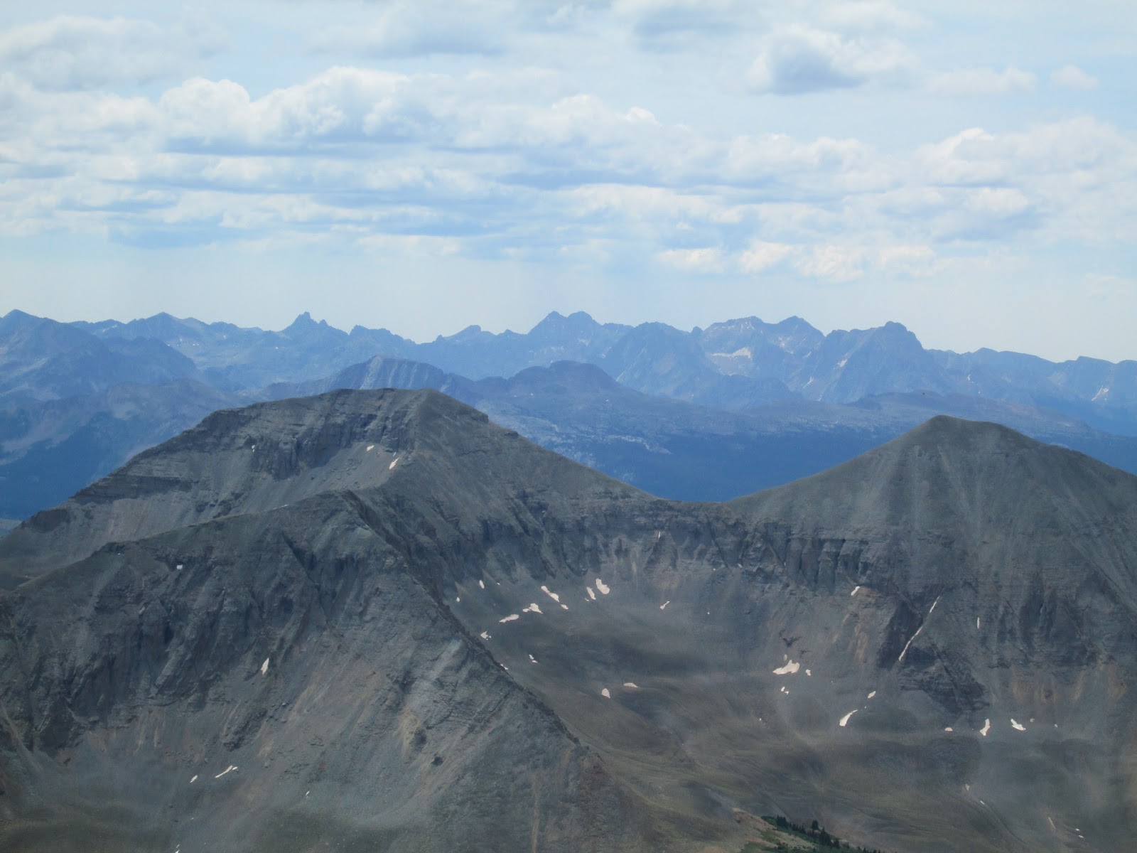
Reaching the top also wasn’t a huge leap in my progression. It was the product of weeks of physical therapy and smaller hikes, including one to 12,100’ in the same general area. Still, it was an ethereal feeling to once again stand on an alpine summit, with miles and miles of unobstructed views of the mountains I love.

James Peak and Rocky Mountain National Park

I couldn’t have asked for a better crew. Kate and I had planned this hike for a week or two, but our friends James, Paige and Ben joined at the last minute. It was especially good to spend time with James, who will be moving to California in June.

We rendezvoused at the trailhead outside of Alice, Colo., a bit after 7 a.m. I hadn’t done much research, but I’d climbed adjacent Mt. Bancroft via the classic and technical East Ridge a couple years ago. I knew the Southeast Ridge of Bancroft was super mellow, and from the Bancroft summit Parry Peak was only a hop, skip and a jump away. 

My estimated time for the trip was six hours. Needless to say I was surprised to be staggering back to the car, utterly exhausted, nearly nine hours later. This was mostly my fault, as the required distance was much longer than I'd anticipated – somewhere between 10 and 12 miles. We also spent a lot of time socializing and lollygagging on summits.

At any rate, the weather was pretty darn good for mid-April. It was overcast and slightly windy as Sunday’s impending storm rolled in, but the temperature was downright balmy, skyrocketing into the 40s.

We snowshoed up a Forest Service Road to Loch Lomond, then traversed over Bancroft’s East Ridge to the plateau dominated by Lake Caroline. We gratefully stashed our snowshoes here, as the rest of the hike looked mostly dry. The route circled the bottom of Lake Caroline until we ascended a mellow slope to the crest of the Southeast Ridge. From there, it was a simple ridge walk on snow, tundra and talus to Bancroft’s summit.

False summit of Mt. Bancroft

Happy pups on the final snow slope up Mt. Bancroft

After a long break, we set off for the true goal of the day, ranked 13er Parry Peak. The connecting ridge went quick and easy, with the most interesting part coming near the top of Parry where one has to angle left around a large cornice. We found a safe line without much trouble and enjoyed the warm, windless summit. Our stay was cut short by darkening clouds.

The snow storm held nicely, however, and we took another extended break during our re-summit of Bancroft. Following the path of some skiers, we decided to descend straight down a moderate snow slope to Lake Caroline, rather than retrace our steps along the undulating Southeast Ridge. James glissaded, but I’m still babying my shoulder and the rest of the group joined me in plunge-stepping down. This decision saved us at least half an hour. 

Me, Remy and Kate on Parry Peak

The gang on Mt. Bancroft (again)

Parry Peak, from Mt. Bancroft

Unfortunately, James wasn’t wearing gaiters and his calves got pretty badly scraped when his pant legs slid up while glissading on neve. I got to put my recently acquired Wilderness First Aid certification to use patching him up. I’ll send him the bill for the gauze and bandages.

We located our snowshoe stash and staggered back down the road to the trailhead. Below treeline, the wind died completely and we baked in the afternoon heat. It was the first time since October I felt comfortable in only baselayers. We finally reached the cars, much more tired than expected, at about 4:15 p.m. James rushed home to tend his wounds, while I enjoyed a burger the size of my head with Kate, Ben and Paige at Capitol Grille in Golden.

Patching up James

With another recovery milestone reached, my plan is now to continue mellow 13ers in the coming weeks. The hope is to get on more interesting stuff by about mid-May. I need to get reacquainted with steep snow and a heavy pack before my trip to the Pacific Northwest in early July, but for now I’m content with whipping my fat ass back into shape and enjoying time with friends in the hills. Thanks to James, Kate, Ben, Paige and the pups for an awesome day.

Monday, April 7, 2014

The Carrot on the Stick

June 27, 2014. That's exactly five months post-surgery, the timeframe my surgeon gave for a full recovery. If I played a contact sport, and my rehab went as planned, that's when I'd be cleared. So walking around on some glaciers and swinging an ice tool or two should be fine by then, right? It's not like I'll be slinging baseballs or performing swim-moves against Offensive Tackles.

At least that's what I've told myself since the day I decided to have surgery. I'd miss ice climbing, winter 14ers, the beginning of couloir season -- but June 27 wouldn't so bad, because that just so happens to be the sweet spot for climbing in the Pacific Northwest. A hazy outline of a potential trip formed in my head even before I went under the knife, and it continues to serve as the carrot on the proverbial stick.

A return to Liberty Ridge, despite offers from solid partners, wasn't what I wanted. Part of the joy I derive from mountaineering is exploring different places and reveling in new experiences. I'll go back to Liberty Ridge one day, probably soon, but attempting it a second year in a row just doesn't instill the same sense of wonderment. I want to immerse myself in an unfamiliar route and get to know a new slice of mountain. After much research and discussions with potential partners, an extended glacier romp has finally taken shape for June 28 (or 29...or 30...) through July 6.

Mt. Adams: Adams Glacier, Grade III, AI2


Adams Glacier

This route is appealing for an obvious reason: I've never climbed Mt. Adams. Much easier options exist on the south side of the volcano, but the Adams Glacier is considered by many to be the most classic line on "Washington's Forgotten Mountain." Basically a giant icefall, the route weaves its away through crevasses and seracs on 40/50-degree snow and ice for 5,000 feet. The technical sections allow access to the easy summit plateau, where the successful climber is rewarded with a half-mile snow slog to the true summit.

The glacier changes from year to year, with trip reports varying wildly from protection-less moderate snow climbing with only a piolet to 70-degree ice pitches with screws and pickets. I'm hoping for somewhere in between. The descent is via the infamously loose and rocky North Ridge. Sam Sala will be my partner on this climb.

Mt. Rainier: Kautz Glacier, Grade II/III, AI2 


Kautz Glacier

In terms of difficulty, the Kautz Glacier falls somewhere between Liberty Ridge and the standard DC/Emmons walk-up routes. Early in the season it's a straightforward snow climb, but as the powder transitions to neve and ice, many people prefer a second ice tool. Starting from the Paradise trailhead with the masses heading for the DC, the Kautz route variates at Glacier Vista to cross the Nisqually Glacier. The Turtle Snowfield and Wapowety Cleaver lead to rocky Camp Hazard at 11,500'.

The most dangerous part of the route is traversing under the massive Kautz Ice Cliff to reach the Kautz Ice Chute, a moderate-to-steep section of ice and snow. Above the chute, a couple hours of glacier-walking leads to Point Success and the true summit at Columbia Crest. Our permits are for 6/30 through 7/4, allowing for maximum flexibility. Sam Sala and Keegan Young will be my partners for the Kautz.

Others?


The routes described will take two days each in ideal weather. We haven't bought plane tickets yet, but it's possible we could swing as long as an eight-day trip. The need for weather days is pretty much a certainty in the PNW. If we get a miracle week-long window of bluebird skies, however, we're even looking into options for a third route. The possibilities are endless. Now if you'll excuse me, writing this blog post has inspired me to hit an extra set of rubber-band exercises...

Friday, March 21, 2014

The Shoulder Story

PART I: Injury


Partly for my own recollection and partly to answer the FAQs from my friends, I figured it would be smart to write down a timeline of my shoulder issues to date. With this baseline established, I can provide periodic updates and track my progress going forward. I've spent a few hours this week trying to find similar rehab stories (Bankart Repair) on the Web, and there aren't many out there. Maybe this will help someone a year or two down the line as they Google search for first-hand info like I have.

I had no history of shoulder problems. In fact, I've always considered my right shoulder to be particularly strong. I was an above-average thrower with many years of baseball (3B), football (QB) and more recently kickball (3B/Pitcher) under my belt.

My shoulder experienced an anterior dislocation for the first time on Saturday, Sept. 28, 2013, at the age of 27. I was playing in a charity kickball tournament. Diving back toward first base after a caught fly-ball, my hand got stuck on the grass and forced my shoulder back and up. I knew immediately what had happened. I could only move my arm at the elbow and the pain was excruciating. The trainer on the field decided not to reduce the dislocation on-site, so after he applied a masterful splint I was on my way to the University of Colorado Hospital in Aurora. My girlfriend, Kate, managed to hit every pothole in her path. I think she was doing it as revenge for some unspoken wrong I'd caused her.

The ER doctor popped my shoulder back into place without pain killers or sedation roughly 1-1.5 hours after it dislocated. This part was much easier than I was anticipating. He positioned my arm by my side like an "L," with my fist extended in front of my ribcage. Then he slowly rotated externally while a nurse applied pressure to my chest to hold me in place. A few seconds of intense pain later, there was a gentle click and all was well.


Ouch

All patched up


I wore a sling for about a week. My range of motion returned and the pain faded. I knew I was now prone to subsequent dislocations, but I figured I'd never had issues before and physical therapy would have me as good as new.

Well, almost exactly two months later, I was watching the Panthers vs. Patriots game on Monday Night Football. I felt like my shoulder was back close to 100 percent. When Ted Ginn caught the go-ahead touchdown for my beloved Carolina Panthers, I pumped my fist. Nothing dramatic, not a full blown punch or anything, just a subdued little fist pump. There wasn't much pain, but I recognized the sensation and the tingling right away. My shoulder had slipped out again. I asked my buddy Ryan sitting next to me to repeat the motion the ER doc had performed, and sure enough it clicked right back into place. The next morning my range of motion and pain level returned to what it had been about a week after the initial dislocation.


Ryan, the hero of the second dislocation, with some poop on his shirt


Surgery now became a serious option. I throw, I climb, I'm active. Recurring shoulder instability would completely change my lifestyle. I met with a surgeon who explained that I'd experienced something called a Bankart Tear (or Bankart Lesion).

As I understand it, whenever anyone dislocates a shoulder, part of the labrum rips away from the bone. All of the correlating muscles, tendons and ligaments thus become looser than they were before, resulting in instability of the shoulder socket. A Bankart repair procedure reattaches the labrum to the bone using dissolving sutures as anchors.

PART II: Surgery


I scheduled my surgery for Wednesday, January 29, 2014. I spent the interim two months of purgatory enjoying myself as best I could, even squeezing in a few 14er hikes and an ice climbing trip to Ouray. I didn't have much pain, but the best way to describe it was my shoulder just felt unstable. Loose. I couldn't trust it, and that's not a good feeling when you're hanging by an ice tool 60 feet above Uncompahgre Creek.


Ice climbing in Ouray over New Year's


My only prior experience with surgery was a knee scope in high school (Lateral/Collateral Release), and by comparison this one was a breeze. The anesthesiologist stirred up a cocktail of drugs that kept the nausea at bay, the pain upon waking was minimal and I avoided the need for a nerve block. I hardly even felt any discomfort and stopped taking the pain medications after only four days. I returned to work seven days later and wore the sling continuously, except for typing and bathing, as directed for the better part of three weeks.

Even out of the sling, the only physical therapy I was allowed to do were pendulum swings. Recovery progressed rapidly. Unfortunately, during my first checkup with my surgeon's PA, I was informed not to start setting real PT appointments until the six-week mark. That wasn't what I wanted to hear. I felt good and was eager to take a more proactive stance toward recovery. Mostly abiding by his rule, I set my first PT session for five weeks post-op.

It went better than I could have imagined. I could do all of the exercises the therapist assigned without pain, so much so that he gave me extras usually reserved for later weeks. I skipped right over the entry-level yellow rubberband and onto the intermediate orange. The therapist said I was way ahead of most people, and I left energized and grinning from ear-to-ear.

PART III: Peaks and Valleys


I climb peaks as a hobby, and six weeks after surgery I felt like I was on top of one. My range of motion was still severely limited, but I couldn't remember the last time I'd felt much pain. I was doing PT for an hour a day, went on a couple hikes, and enjoyed the company of friends for my girlfriend's birthday and St. Patrick's Day. No pain. I was even starting to feel strong.

Then I woke up Monday, March 17. The pain had returned with a vengeance. I could hardly drive my stick shift, something I'd been doing since about 2.5 weeks post-op. Panic set in. What if I'd done something to tear the sutures, or if those had dissolved already, the labrum back away from the bone? I went over everything I'd done the previous day. Nothing stood out as dangerous. I'd spent most of it on the couch.

So I went back to the weekend. I'd gone for a short hike/run Thursday, also the last time I'd done my PT exercises. As part of a WFA class, I'd helped drag a person about three feet in a mock scenario. That night I'd gone out to celebrate St. Patrick's Day. I got a few hugs, shook a few hands, supported a friend's legs (with help, using mostly my good shoulder) during a keg stand. Sunday I threw a frisbee -- once, about 15 feet, using mostly my wrist -- for my dog. I definitely hadn't fallen, which my surgeon said was the most dangerous threat.


Hike of Bear Peak, early March


Yet, my shoulder felt back to where it was two or three weeks after surgery. There was a deep, burning, throbbing ache right over the largest incision. Monday night I even had to sleep in my sling again for comfort. What gives? Everyone told me I was being paranoid, or exaggerating. To be honest, I was terrified. What if I'd somehow damaged the repaired area? I kicked myself for not babying it more, for doing all of those activities listed above.

It's gotten better throughout this week, but even sitting here Friday morning, some pain remains. More than there was last Sunday, for sure. I'm optimistic I'm fine, telling myself I just slept on it wrong, or that all of my activity last weekend had a cumulative effect. But a lot of lingering doubt remains. If I did somehow manage to re-tear my labrum, the result would be five months and thousands of dollars down the drain.

For half a year, this shoulder issue has prevented me from doing the activities that sustain me. I might be paranoid or exaggerating, but not exactly without cause. I'm in the prime of my climbing life, and instead of accomplishing all of the dreams and goals I'd concocted for this winter, I've spent most of it in a sling. I'm ready to be healthy. Considering the possibility of a failed surgery and continued instability makes me break out into a cold sweat.

PART IV: Climbing Out


I've leaned exclusively on my girlfriend during my recovery, and my recent week of nagging worry has been especially draining on her. I can't say enough how thankful I am for all of her love and support. She's imploring me to be more positive, and she has a point.


San Francisco with Kate, during the sling's final days


There's always someone that has it worse. In my case, lots of someones. My surgery was unbelievably minor in the grand scheme of things. I can still walk, I can take care of myself, I can work. I have my mental health. I'm not dying. I met with my doctor Monday for my six-week follow-up, and he seemed very unconcerned about my newfound pain. I'm not entirely sure I voiced correctly what I was trying to convey (I left out the keg stand part), but still, he kept on coming back to falls being the big danger. I hadn't fallen.

The doctor said there would be no way to tell if the surgery failed, unless another dislocation occurs. Re-tear or not, the next step is the same: total dedication to physical therapy. That's all that's in my control, so I might as well stay positive.

I was told five months for a full recovery, meaning if I played contact sports or pitched baseballs for a living, that's when I'd be cleared. For more normal stuff, I should have full range of motion and limited pain by the three-month mark -- the end of April. That's the next goal to work toward. If I clear that hurdle, maybe I'll even be able to squeeze in some snow climbs by mid-May. A boy can dream.


Did someone say snow climb?


Whatever happens, I'm going to try to be more upbeat and keep everything in better perspective. If I don't and the surgery did in fact fail, the next time Kate is driving me to the hospital after a dislocation, she might hit even more potholes.

-Jeff

Sunday, March 16, 2014

Baby Steps

My subconscious has successfully translated my physical therapist's more conservative verbiage into "you're cleared to start hiking easier stuff," and with Daylight Saving's Time taking this week, I decided it was high time to get back on the trail.

I'm now six weeks out of surgery. Physical therapy has started in earnest, and I have very little pain doing normal daily activities that don't involve reaching overhead. Though my shoulder still feels weak and tight, hiking is a fairly pain- and risk-free endeavor. (As long as I don't fall on it. That would be bad. Let's put that out of mind.)

Saturday dawned gorgeous. After sleeping in a bit, I saddled Remy with his pack and headed for Bear Peak. Somehow I'd avoided doing this hike for nearly four years, mostly because the trailhead is in Boulder and Boulder sucks. Boasting roughly 3,000 feet of gain, however, the trail to the summit promised to be a great workout. I'd just have to avoid eye contact with the Boulderites, who are most insufferable in their natural environment and easily provoked into discussions of gluten, CU "sports," Subarus or their trust-funded trip trek through Tibet.

It had snowed 3-5 inches Friday. I'd hoped the trail would be mostly packed snow, but there's no denying that spring is around the corner. Already, starting from the NCAR trailhead at 10:30 a.m., the trail was a quagmire of ankle-deep mud. Remy had to suffer through being on-leash for a few miles until we reached the Fern Canyon Trail and I felt sufficiently secluded. I won't incriminate myself, but let's just say giving money to the City of Boulder isn't high on my list of priorities.

Finally, there was enough snow that mud became a non-issue. The trail got steeper, and even with Microspikes I didn't feel super stable. Paranoia of falling attacked with a vengeance. I pressed on to slightly above the saddle with S. Boulder Peak, but there the hard-packed trail turned into a veritable bobsled run. I slipped three times in succession and decided to call it a day, roughly 700' from the summit. It was still a gorgeous hike with more than 2,000' of elevation gain. Easily the best workout I've had in two months.

Mt. Meeker and Longs Peak


Flatirons


Working in Golden certainly has its share of benefits. High on that list is a bevy of accessible trailheads within 15 minutes of my office. With Daylight Saving's Time delivering sunshine until roughly 7 p.m., taking advantage of nearby Open Space parks after work is a no-brainer. I was busy most of this week, but finally had time to hit Mt. Galbraith on Thursday evening. It's simply a fantastic little hike. Microspikes were once again beneficial, but there was almost no mud to worry about. Briskly walking up and jogging slowly (again, no falling!) down, I went from car-to-car in about an hour and 20 minutes. Requiring slightly less than 1,000' of gain, it's not exactly a leg-buster, but for an easy evening jaunt it's hard to beat. The views of Denver and Centennial Cone ain't bad, either.

I'm very excited about both of these excursions. My return to the true mountains -- and my former physical shape -- finally feel within reach. April is going to be a great month.

Denver from Mt. Galbraith


Thursday, February 13, 2014

The Road to Recovery

I haven't updated this blog in months. Oops. At least I have a good excuse: I sprained my knee in early September, and once that was about healed up, I dislocated my shoulder in a charity kickball tournament. The shoulder instability lingered and I ended up having surgery Jan. 29, after a second dislocation, to repair a Bankart Tear.

I got outside plenty in the fall and winter, but didn't accomplish much I considered blog-worthy. A failed attempt on Fletcher and successful trips up Silverheels, Buckskin, Homestake, Pikes, Sherman, Gemini and Evans (my lone new winter 14er this season) kept me sane, but all of those are relatively short walk-ups. I was even lucky enough to go ice climbing a few times, most notably during an amazing New Year's Trip to Ouray. It was tough sticking to easy WI2-3 and not being able to trust my dominant shoulder, but I'm thankful I was able to at least swing my tools a few times this season.

Pikes Peak summit with Kate, Remy, John and Loren.

It's admittedly difficult watching friends out there accomplishing great things. On one hand I'm happy for them, and on the other there's an undeniable pang of envy. There's even a sense of being left behind as I see people I was once on par with skyrocket past. With avalanche danger reaching atrocious levels, the only thing I'm not internally conflicted about is hoping they all stay safe.

Paraphrasing something my close friend Mark said recently while going through a much more difficult situation with a torn Achilles, there's nothing to do now but hit the rehab hard and stay focused on the future. What's done is done, and there's no use wallowing in my own tears over a lost winter season. All I can do now is focus my energy toward getting back to 100 percent.

Three things will see me through: Kate, who's been (mostly) patient despite my best efforts at milking the recovery; an obstinate hope that I'll be able to climb by couloir season in May; and an early July trip to the Pacific Northwest for the third year in a row. There's certainly a lot of fun to look forward to on the horizon.

I'm off now to my first post-op appointment. I'm hoping to learn when the sling gets retired and when physical therapy will start. Once those dates are set, it's go time. Recoveries are a lot like climbing a mountain -- if you stay fixated on short-term goals and take it step-by-step, before you know it you'll be on top.

Climb on.

-Jeff

Ouray Ice Park


Tuesday, July 30, 2013

A Week Among the Clouds

INTRODUCTION

Liberty Ridge. The classic Grade III/IV snow-and-ice route on the insidious North Face of Mt. Rainier has earned innumerable superlatives; many consider it among the best climbs in the Pacific Northwest. An equal number of others, of course, dismiss it as overrated.

Featured in Roper and Steck's prestigious Fifty Classic Climbs of North America, the ridge splits the rarely climbed Willis and Liberty Walls, providing a relatively safe line to the summit at the cost of an arduous approach across the Winthrop and Carbon Glaciers, sustained steep snow, at least one pitch of alpine ice (often more, as our team would discover) and an alternate descent route requiring climbers to carry heavy packs up and over the 14,411-foot summit.


North Face, Mt. Rainier

Immediately after summiting Rainier via the standard Disappointment Cleaver route in July 2012, I e-mailed my regular climbing partners about a big trip in 2013. The responses varied. As usual, however, Rob Jansen and I were on the same page. We knew it would take a year’s worth of dedicated training to make ourselves worthy of the challenge, but Liberty Ridge became the object of our obsession.

Sadly, Rob passed away in late August 2012 in a rock slide on Hagerman Peak before the trip progressed beyond the planning stages. At the time of his death, we'd climbed more than 25 mountains together in a mere 10 months. The loss of my close friend and No. 1 climbing partner shook me to my core. His father told me during the memorial service to keep "carrying the torch" for his son, and I knew that meant going forward with our mutual dream of ascending Rainier via our dream route.


James Graham and Darrin Nicholas were my mentors as I transitioned from East Coast beach bum to 14er finisher, and I count both among my closest buddies. It was a special moment for me when they invited me to join their own Liberty Ridge attempt a few months later. I readily agreed.


The reality, however, was that James is a good deal heavier than us, and the crevasse danger on the Carbon glacier is real. Darrin and I might have had problems if James took a fall. For that reason we added a second rope team to the party, consisting of three other climbers: Nao Takano, Keegan Young and John Fatseas.

I applied for and was awarded a Live Your Dream grant from the American Alpine Club for the climb, and without such support this trip wouldn’t have been possible. A huge thank you to everyone at the AAC for allowing me to live not only my dream, but one which Rob and I shared. I'm also indebted to Eddie Bauer/First Ascent Park Meadows, which let us demo a First Ascent Katabatic when we needed a second three-man mountaineering tent.


Climbing expeditions rarely go as planned. The trip I'd imagined as we boarded our plane on the morning of Saturday, June 8 was vastly different than the trip I’d experienced by the time I was on the return flight Sunday, June 16. I can say without a doubt, however, that the vacation was a success for our entire six-man team, and everyone made the correct decisions for themselves. We came home alive, we came home friends and we came home with summits.


MT. RAINIER - LIBERTY RIDGE

Weather windows in the Pacific Northwest are rare, especially in June, and we were graced with a beautiful one. Sunday and Monday were mostly sunny with no chance of precipitation during our approach, and Tuesday, our summit day, called for partly sunny skies with a small chance of precipitation toward the evening. A minor storm was forecast for Wednesday and Thursday.

The ranger at White River told us to bring snowshoes, which caused a communal groan heard as far away as Paradise. Previous parties reported chest-deep snow followed by bare ice from 12,500’ to 14,000’. The ice beta proved accurate, but the snowshoes stayed on our packs for 98 percent of the trip.


Setting off

The meandering trail from the White River Campground switchbacks ever upward, crossing streams and offering fleeting views of Rainier’s upper reaches. We started encountering snow around 6,000’ and finally popped out above treeline onto the Inter Glacier after 2.5 hours of hiking.

Some donned crampons here, while I opted for snowshoes because I figured the heel lifts couldn’t hurt for the slog up to St. Elmo’s Pass. We entered our own little worlds and formed a strung-out line on the crevasse-free Inter Glacier, ascending at various paces. Gaining St. Elmo’s Pass meant traversing onto the Winthrop Glacier and the removal of ~10 pounds each worth of ropes and hardware from our packs. Motivation came easy.

Roped to Keegan and Darrin and followed by Nao, John and James, we set off across the glacier. The Winthrop is hideous up high, but our line stayed flat and angled slightly down toward Curtis Ridge. We crossed our fair share of crevasses, maybe a dozen, but all were less than a foot wide that early in the season. 


Crossing the Winthrop Glacier

The lower slopes of Curtis Ridge are wide and deceiving. To make matters worse, a cloud-and-fog layer rolled in and obscured our views. Time and time again, we thought we’d reached camp, only to see more ridge awaiting ahead. The best advice I can give to prospective parties is when in doubt, angle down (right). The best campsites are around 7,200’ to 7,400’. The Carbon Glacier is easily accessed by a 50-foot scree slope lower on Curtis Ridge, but you’ll become cliffed-out by ascending too high.

We pitched our two three-man tents in the only flat spots we could find. The fog occasionally gave way to teasing glances of Liberty Ridge above. Every time we climbed a nearby cliff to scout a safe path across the Carbon, clouds reappeared. The routefinding would have to wait for morning. Our bellies full and snow melted, we crashed as soon as we could, with alarms set for 4:30 a.m.


Curtis Ridge Camp, with Liberty Ridge partly shrouded behind

Cue the best sunrise I’ve seen in my life. It took a full 20 minutes longer than usual to get ready because I couldn’t pick my jaw up off the talus. Finally ready to move an hour and a half later, we were ecstatic to find the short scree slope onto the Carbon Glacier within a stone’s throw of our campsite. The early morning light on Liberty Ridge revealed our beta was accurate: everything above the Black Pyramid was a shimmering field of ice.


Liberty Ridge

Some consider the Carbon Glacier the most dangerous section of the entire route. It’s Rainier’s thickest, longest and most active glacier, with a reported depth of 750 to 900 feet. Massive crevasses yawned everywhere. The morning quiet was interrupted at regular intervals by the gunshots of collapsing seracs. A 30-second waterfall of rocks fell from the toe of Liberty Ridge itself, and hundred-foot-wide avalanches swept silently down the Liberty and Willis Walls, threatening anyone who got too close. It was time to focus.

Despite the surrounding dangers, we raced across the Carbon. The flat, middle part of the glacier was remarkably lacking in open crevasses. Above the 7,600’ level or so, the routefinding became more tricky. We routinely had to step over foot-wide crevasses, including one on an uphill slope that required the solid placement of an ice axe pick for most of us, and another that was actually two crevasses with a thin intervening platform. We also trod through a small icefall, weaving around seracs and over a wonderland of snow formations. It was dangerous, sure, but my God was it beautiful. Even now I smile in reflection.


Onto the Carbon Glacier

Above the icefall, the glacier once again flattened out and we stopped for a break. The entrance to Liberty Ridge was less than an hour away. Another serac collapsed on the Liberty Wall, starting a minutes-long avalanche that appeared close enough to touch. We started again, but stopped a few hundred feet later to have a group meeting that would change the course of my week.

Break time on the Carbon


For several valid reasons, James expressed that he was throwing in the towel. The rest of the group wanted to press on, including myself. Backtracking over the wicked Carbon and the milder but still broken Winthrop was inarguably roped-up terrain. James walking out alone, especially with the day heating up, would be taking an enormous risk.
 

I wanted the route more intensely than any I've attempted in my life and I couldn't have felt stronger. I'd trained hard, given up drinking for months, learned a ton of new skills, read and re-read trip reports and route beta, sought grant opportunities with the AAC -- it's not an exaggeration to say Liberty Ridge dominated nearly a full year of my life.

I searched inward. This climb, for me, was as much about remembering my friend Rob as achieving personal success. Every step was one I should have been taking with him. I began to wonder what Rob would do in that situation. He was one of the most selfless climbers I ever met, and there on the glacier I recalled a memory I shared during his memorial service. Long story short, he once told me, “You’re my friend, and I’d do anything for you.” James is one of the better friends I have. I understand how cheesy it sounds, but my choice was suddenly made for me. With only a touch of reluctance, I opened my mouth and told James I'd head down with him.


Before another half-hour passed we had the ropes reordered, the gear redistributed, and the respective teams of four and two were ready to go their separate ways. Darrin was already ahead, but as John, Keegan and Nao trudged by, I shared a moment and a hug with each of them. I wished them sincere good luck and lent John my camera. Then, it was time to go down.


MT. HOOD 

Mt. Hood, South Side

The plan was to take a rest day or two while waiting for John, Darrin, Keegan and Nao to come off Rainier and join us for an attempt on Mt. Hood. Unfortunately, the other members of our party ended up having such an epic on Liberty Ridge that they decided against any more climbing and caught early flights home. James and I headed down to Hood on our own. We were joined by good friend Bill Wood, who found a cheap last-minute flight from Denver to Portland.

While Mt. Hood’s standard Hogsback route pales in difficulty compared with Liberty Ridge, the highest point in Oregon is no slouch. Hood, simply put, is aesthetic. It’s often said that if you ask a kindergartner to draw a mountain, the picture you’d get in return is Mt. Hood. The slopes sweep upward from all directions to reach a perfect pinnacle, eternally capped with snow. From certain angles the mountain calls to mind Wham Ridge blanketed in white.

After waiting out a few days of imperfect weather, Friday promised to be better. It didn't seem that way when our alarms went off at 3 a.m. Outside the Best Western, the world was shrouded in mist. A startlingly chill wind whipped us from all directions. Regardless, we were there, we were awake and this was our one shot. We piled into the rental car and drove up to the trailhead at Timberline Lodge.

I was on a mission. Most parties hit the trail closer to midnight, but we cocky Coloradans were lazy and aimed for a 4 a.m. start, which in actuality became 4:30. I was concerned about being forced to turn around by late-morning falling rocks or ice, or the cloudlayer rising with the day’s heat. As has been proven in tragedy after tragedy, the upper slopes of Mt. Hood are no place to be caught in a whiteout. Though we carried ropes and a small rack as a precaution, the likelihood of needing them was nil. I bolted for the summit as fast as I could manage, with the mutual understanding I’d stop to wait for James and Bill if conditions warranted.


Sunrise over a cloud layer on Mt. Hood

My personal goal was to top out by 9 a.m. Maybe it was my Colorado acclimatization, maybe it was my fear of leaving the Pacific Northwest without a summit, or maybe I was simply channeling my inner Rob Jansen (he was an exceptionally fast hiker and finished 33rd in the 2012 Leadville Marathon), but I was shocked to find myself on the summit at 8:30 a.m., four hours after setting out.

The first 2,500’ of the route is as boring as snow climbing gets. One literally walks up a ski slope, using a chairlift as a guide. The views we had that morning made even that portion enjoyable. The entrapping cloudlayer leveled off at about 6,000 feet, the same elevation as the trailhead. We were soon above it. Sunrise hit early because of our late start, and it presented an astounding scene coupled with the low clouds, nearby Mt. Jefferson and Hood’s own mountain shadow.


Hogsback and Mt. Jefferson

I caught a large group of several parties at the Hogsback, where everyone stopped to put on crampons. Here, only 700 feet from the summit, the route becomes spectacular. Fumaroles spewed wisps of steam that polluted the air with sulphur, singeing the nostrils; a single crevasse known simply as the bergschrund gaped wide; the Hogsback provided an aesthetic line of ascent and the final push beckoned as a fine snow-and-ice climb.


In years past, the Pearly Gates -- a direct line from the top of the Hogsback to the summit -- was the standard route. Recent shifts in weather have made this section steeper and icier, so most climbers traverse left to a snowfield known as the Old Chute. Now ahead of the masses, I took the middle ground, up a narrow tunnel of hard 45-degree snow called the Two o’ Clock Couloir, embraced on all sides by towering rocks armored in rime ice. The other parties, including a family of skiers from Aspen, followed up the same route.


Two o' Clock Couloir

The top of the couloir revealed the summit ridge and views unlike any in Colorado. It was the Blanca Group on steroids. Mt. Hood, an ultraprominent peak, offers incomparable scenery in every direction. Mt. Rainier and Mt. Adams rose proudly to the north, while Mt. Jefferson and the Three Sisters were only slightly less impressive to the south. The neutered mound of Mt. Saint Helens was a harsh reminder of the fate awaiting these active volcanoes. 


Summit ridge

After turning around on Liberty Ridge, my chest swelled with the elation of success. I put on my puffy and was soon joined by the other groups, including the Aspenites, who skied from the summit. Bill and James arrived a short while later. Standing at the apex of a mountain like Hood is an awesome personal accomplishment, but it wouldn’t mean nearly as much without friends such as these to share the victory. I spent a few minutes gazing longingly at Rainier, though I didn't dwell; I was happy where I stood.

We lingered on the summit until about 10 a.m., then started down. A combination of glissades and a good climber’s trail saw as back at the lodge before noon, with beers from Mt. Hood Brewing Company in our hands by 12:30. A toast to success!


Mt. Hood summit


CONCLUSION

As I've said, the trip turned out very differently than I’d drawn it up. That doesn’t mean I’d change anything. With a team as strong as the one I had and as hard as I'd trained, I have full confidence I would have made it up Liberty Ridge. But as the cliche goes, the route will always be there. I gained more personal pride in helping a friend in need than I ever would have simply succeeding on a route. People climb mountains for many reasons, and I've discovered that I do it mainly for the camaraderie.

More philosophically, before the trip the prospect of succeeding on Liberty Ridge was almost a sad one. It was the last of many adventures I’d planned with Rob. Once it’s done, I have a feeling I’ll be a bit rudderless for a while. As long as Liberty Ridge remains a dream, something on the horizon and not yet behind, maybe I’ll continue to feel this strong connection to my friend. I’m sure I’ll be back one day. That trip will come when it will. Until then, I’ll continue living other dreams, remembering my lost compatriots in other ways and enjoying the friend that remain to me.


Thanks again to the AAC for allowing this journey to happen. I'm truly living my dream.

Monday, July 8, 2013

My Happy Place

Everyone has one location that makes their heart sing, one place they return to over and over during daydream escapes from daily monotony. It could be a white-sand surfbreak, a sprawling desert maze, a West Texas ranch, an ancient European city, a high alpine basin, a Minnesota lake, a suburban home with a white-picket fence, a Gulf Stream fishing vessel or any infinite number of things. No one is better than another. It's up to the individual to decide what speaks to them, and for me, that place is the San Juan Mountains of Southwest Colorado.

Let's not beat around the bush. Most of the mountains in Colorado are nothing more than big, rounded lumps. That's not an insult. Those peaks are enchanting in their own right, and I always look forward to returning to the Sawatch and Front ranges. The San Juans, however, can be summed up in one word: inspiring. These dramatic peaks rise defiantly, thrusting skyward in jagged pinnacles and sweeping, aesthetic ridgelines. I'm rarely in a better mood than when I'm driving to the San Juans, and each time I lay eyes on them I feel born anew.

Staring at them on innumerable trips on U.S. 550 while I lived in Farmington, N.M., these are the guarded summits that dared me to become a mountaineer. The San Juans are my happy place, and to steal from a famous quote, to me they give lavishly. A day removed from a five-day Fourth of July vacation to SW Colorado with Kate, I feel rejuvenated, reinvigorated and re-energized. I'm not even sad the trip is over. Of course, that's mostly because I'm already planning a return over Labor Day...

I'm failing to find the words to describe this singular place and the ways it makes me feel. I'll quit while I'm somewhat ahead. Pictures can do a better job, anyway: